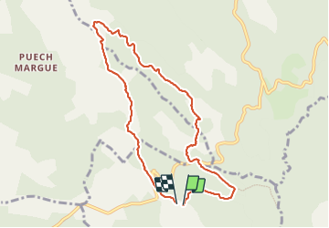
14.1 km | 17.9 km-effort
maubert
RANDO 3 ARS
User
Length
9.1 km
Max alt
829 m
Uphill gradient
160 m
Km-Effort
11.3 km
Min alt
735 m
Downhill gradient
162 m
Boucle
Yes
Creation date :
2023-06-29 07:41:57.705
Updated on :
2023-06-29 10:50:10.979
3h07
Difficulty : Very easy
FREE GPS app for hiking
About
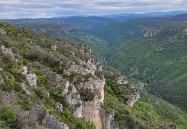
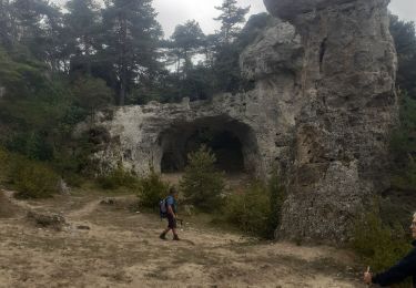
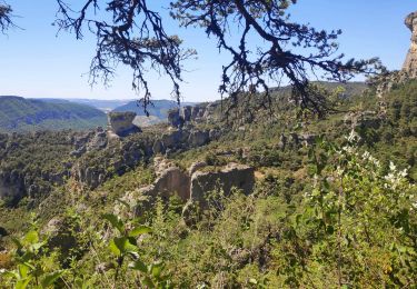
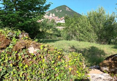
Trail Walking of 9.1 km to be discovered at Occitania, Aveyron, La Roque-Sainte-Marguerite. This trail is proposed by RANDO 3 ARS.
Description
maubert
Positioning
Country:
France
Region :
Occitania
Department/Province :
Aveyron
Municipality :
La Roque-Sainte-Marguerite
Location:
Unknown
Start:(Dec)
Start:(UTM)
515849 ; 4888239 (31T) N.
Comments
Trails nearby
J3 St Jean des Balmes Ermitage St Michel
Walking
Easy
(2)
Veyreau,
Occitania,
Aveyron,
France
9.6 km | 13.9 km-effort
3h 18min
Yes
Sur Les Hauteurs De Peyreleau
Walking
Difficult
(2)
Le Rozier,
Occitania,
Lozère,
France
10.4 km | 18.2 km-effort
4h 0min
Yes
Le 815 - Peyreleau
Walking
Easy
(1)
Peyreleau,
Occitania,
Aveyron,
France
5.5 km | 10.5 km-effort
2h 0min
Yes
Le village de pierre
Walking
Easy
La Roque-Sainte-Marguerite,
Occitania,
Aveyron,
France
3.6 km | 5 km-effort
2h 38min
Yes
les corniches du Méjean (la Jonte)
Walking
Medium
Le Rozier,
Occitania,
Lozère,
France
12.5 km | 23 km-effort
7h 15min
Yes
les rosiers la viale
Walking
Difficult
Le Rozier,
Occitania,
Lozère,
France
12.8 km | 22 km-effort
4h 42min
No
corniche du Tarn et de la Jonte
Walking
Medium
Le Rozier,
Occitania,
Lozère,
France
11.4 km | 20 km-effort
3h 51min
Yes
Ermitage St Michel 19-05-22
Walking
Medium
Peyreleau,
Occitania,
Aveyron,
France
10.3 km | 18 km-effort
2h 50min
Yes